
R i o P a r a i b u n a (de SP)
E x p e d i ç ã o
T R A D U Ç Ã O E M P R E P A R A Ç Ã O
Standard Runs Expedição
The upper part of the Paraibuna is passing through the National Park of Cunha. This section is a real expedition, as you are far away from civilization. The only way out of the forest is the river.
To run this section, you need a permission of the Park Director. But as far as we know, there is no objective criteria for getting this permit. Thus we decided to make our first decent a "bandit run". After we thought that we have already passed the Ranger Station at the park entry, there was suddenly a nice drop. Pedro, at this time our less experienced fellow, wanted to get down first. After landing in the pool, he was so enthusiastic, that he released some yells of happiness. Well, and that was the end of our descent, unfortunately we found out that we were right beside the Ranger Station, and the rangers did not last long to appear L
The following description and pictures are from some friends who would
like to stay anonymous ;-)
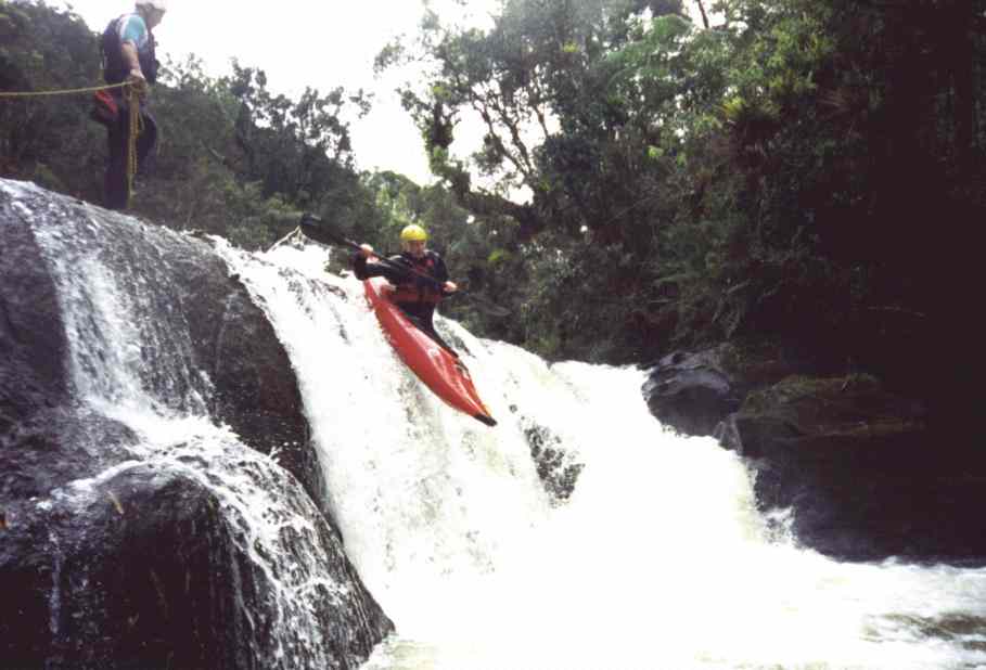
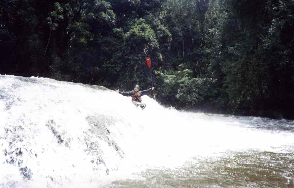
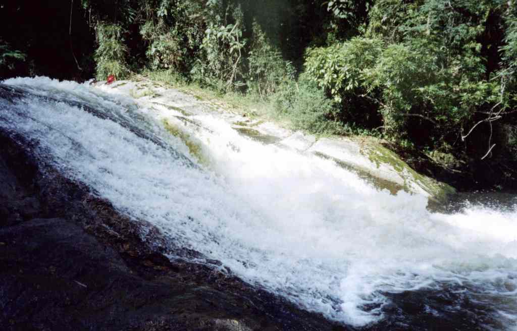
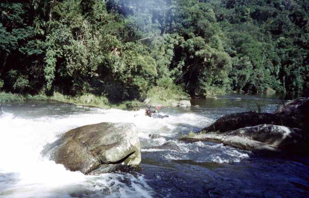
The first drop, just to get warm...
How to get there
From Guaratingetá take the SP 171 in direction to Parati. Approx. 20 km after Cunha there is an indication on the right hand side to the "Parque Nacional de Cunha". Turn right, then go on, another 20 km until you reach the park entry (Ranger Station).
Character
The Upper Paraibuna is a small river. Long stretches of flat water with lots of drops and partially steep waterfalls.
Gauge Information
As a reference, the gauge of the standard runs may be used. Info at Montana Rafting, Tel: (+12) 271 15 72
Put-In / Take-Out
Either at the Park Entry, or better on the first wooden bridge over the paraibuna, approx 2 km before the Ranger Station - this is specially recommended if you take in early ;-).
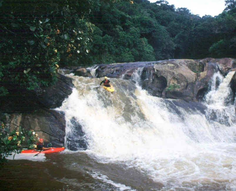
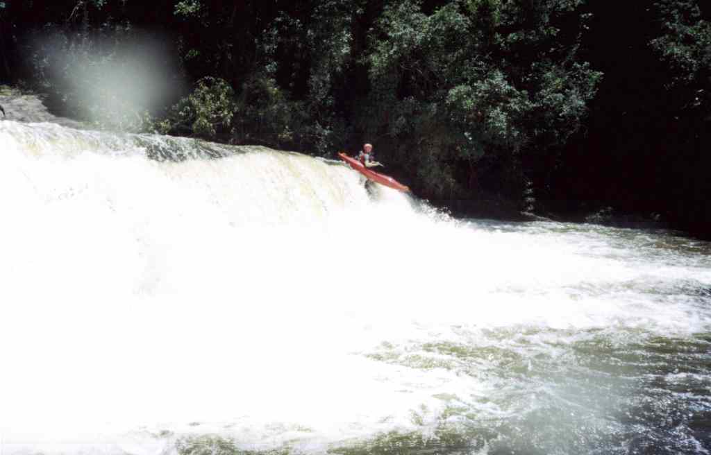
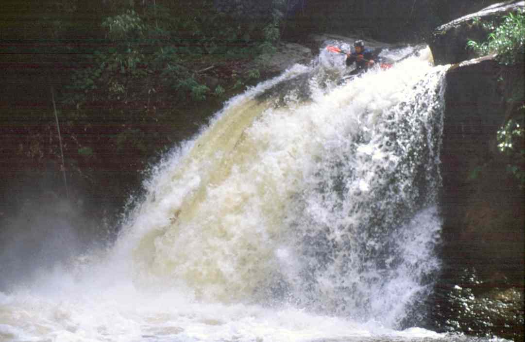
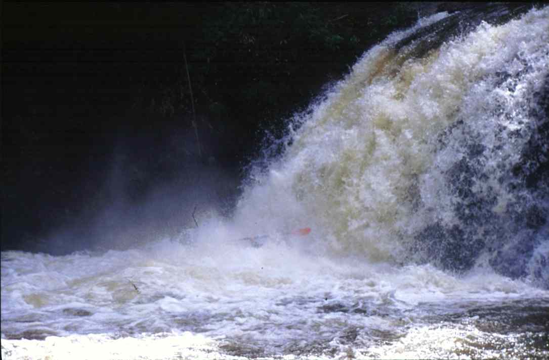
The "Salto do Grito" from above and below
Length
Approx.
40 km, minimum 10 hours without extensive pauses !!
A detailed description of the river is very difficult, thus a first
descent should be made "expedition like". So plan enough time
contingency.
Gauge
As a minimum level, the standard runs should have at least middle water. This is the basis of this description. There are no further experience to classify middle or high flow levels.
Difficulty
WW
II with a lots of drops up toWW IV, minimum 3 X, one V and one VI
At high flows, scouting and portages become very difficult !
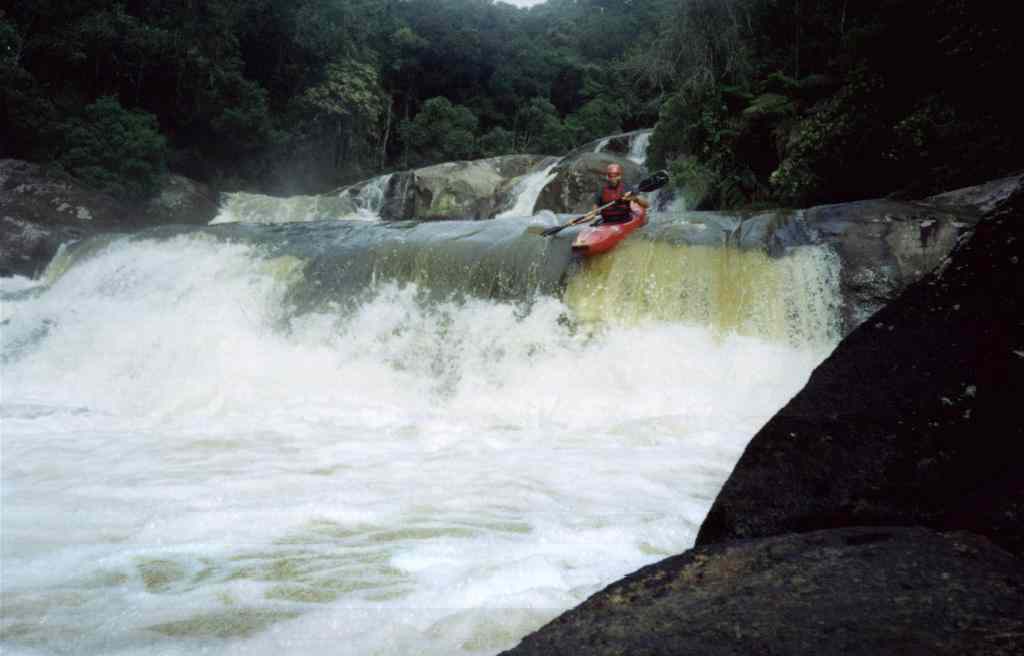
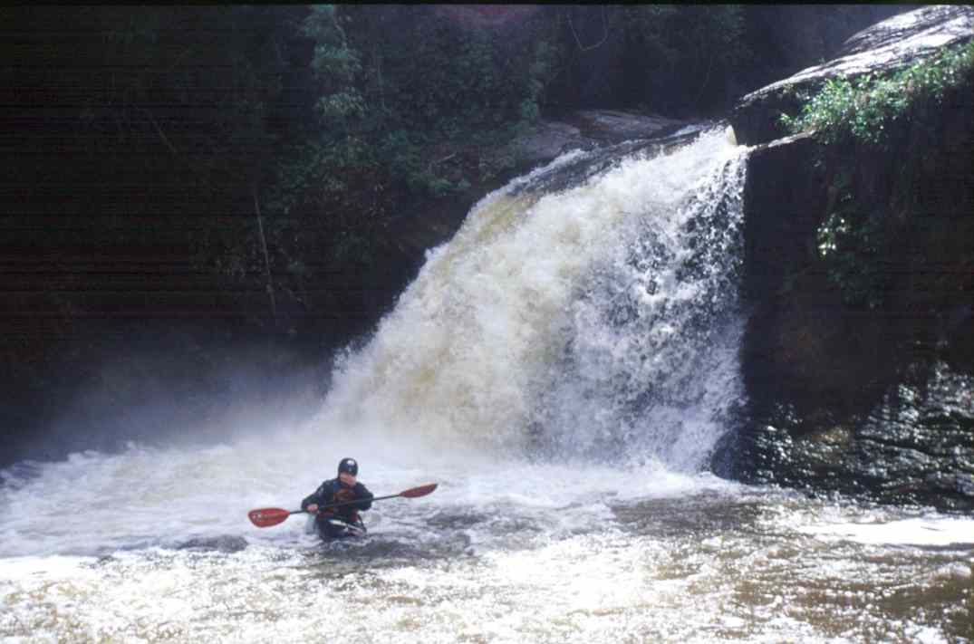
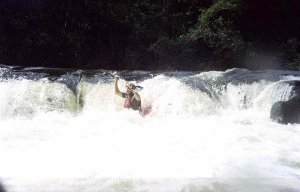
After the "Salto do Grito" it is going on, this drop is followed by a portage. Take out left.
From here on you are entering the National Park.
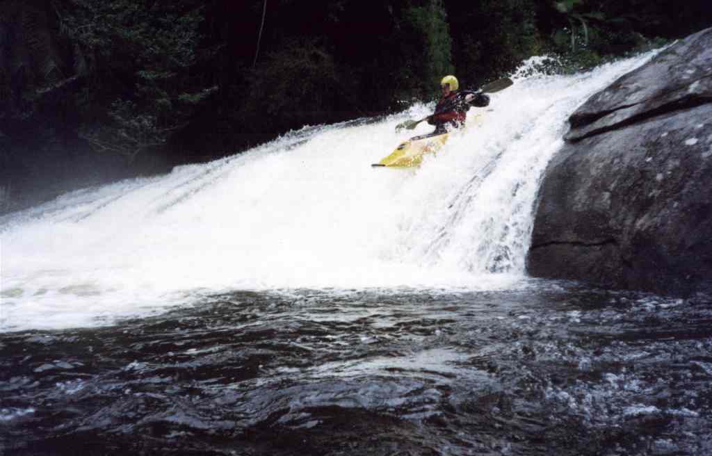
If you see an edge in front of you, better scout - it may be, like here, a funny slight or a drop with only one clear line.
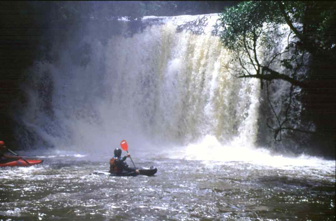
This waterfall should be run very left. J. tried the main current and bend the nose of his Topo...
... the same fall from below.
Who wants to run this waterfall needs to be very sure. There are still around 20 km to the take out. J. did run it - eventually this was the first descent. The other, elderly guys from the team decided to portage... as well as the second fall which is directly following.
Another first descent from J. ?
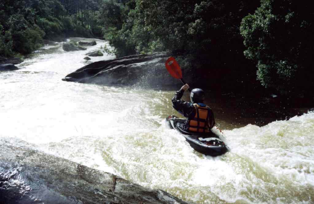
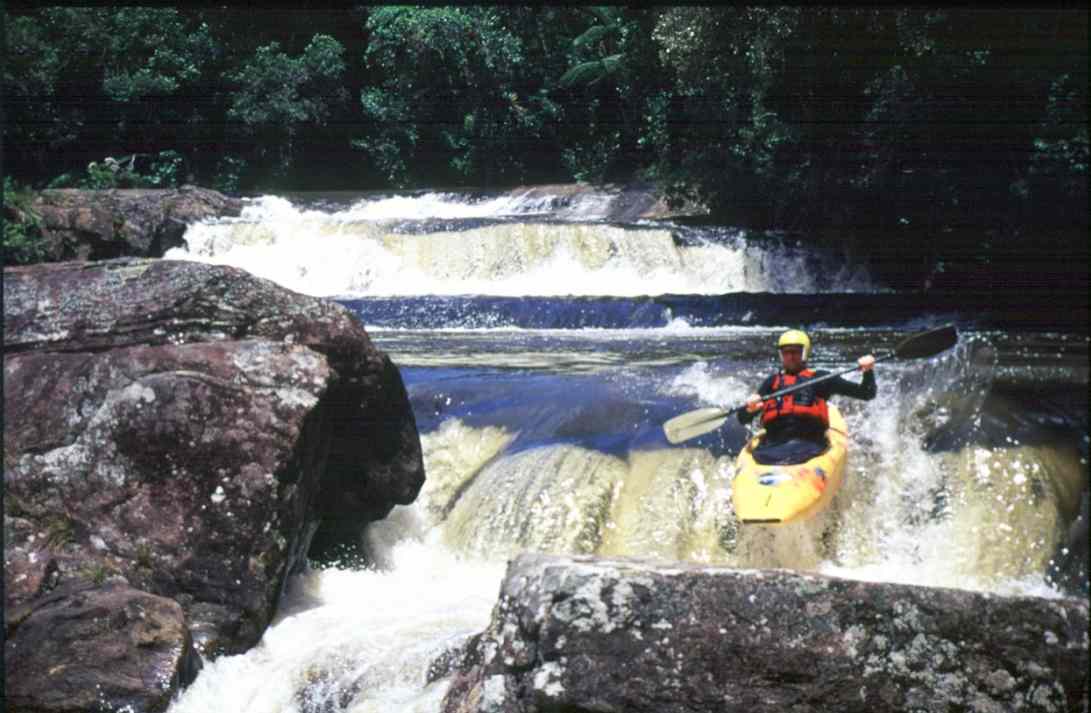
There are lots of drops and slights which are not always easy to scout and sometimes cost some effort to run them...
Photos: J, A Paddlers: J, A, R